- Page d'accueil /
- Livres /
- Reference /
- Atlases & Maps /
- Historical /
- National Geographic Family Reference Atlas 5t...
0 ratings






Numéro d'article:
28848644
National Geographic Family Reference Atlas 5th Edition
87% des répondants recommanderaient ceci à un ami
Numéro d'article:
28848644
€ 56
Détails du prix
Hors frais de livraison et de douane ( Les frais de livraison et de douane seront calculés lors du paiement )
*Tous les articles seront importés depuis États-Unis
37%
En stock
 Importé depuis la boutique USA
QTY:
Commandez maintenant et recevez votre commande aux alentours du Monday, Septembre 28
Transaction sécurisée
Ubuy s'engage à protéger votre sécurité et votre confidentialité. Notre système avancé de sécurité des paiements garantit la confidentialité en chiffrant vos informations lors de la transmission grâce aux protocoles AES (Advanced Encryption Standards) et SSL (Secure Socket Layer). Vos coordonnées de paiement sont 100 % sécurisées car nous ne partageons pas vos informations de paiement avec des vendeurs tiers.
Nos meilleurs partenaires logistiques


Show your kids the world with fascinating facts and more than 650 photographs, maps, and graphics covering every country

Livraison
rapide

Retour
gratuit*

Emballage sécurisé

Produits 100 % originaux

Conformité PCI DSS

Certifié ISO 27001



Note: Step Down Voltage Transformer required for using electronics products of États-Unis store (110-120). Recommended power converters Acheter maintenant.


Ce qui se démarque
Comprehensive Details
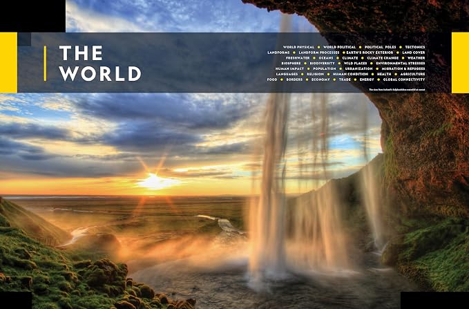
This atlas offers in-depth geographic information, stunning visuals, and detailed maps, making it ideal for families wanting to explore and understand the world together.
Educational Resource
Designed to engage young learners, the atlas combines vibrant illustrations with factual content, enhancing children's knowledge about geography and cultures worldwide.
Durable Design
Its hardcover format ensures longevity and withstands frequent use, making it a lasting addition to family libraries, perfect for years of exploration and learning.
Détails du produit
- Includes physical maps of the world, continents, and ocean floor with detailed landforms and vegetation
- Features political maps highlighting international boundaries, cities, road networks, and more
- Offers thematic maps showcasing physical and biological topics, as well as human patterns
- Provides regional maps dividing continents into subregions with political divisions and major surface features
- Includes fact boxes with flag designs and practical information for each region
- Highlights the impact of climate change, showcasing images of thunderstorms, cityscapes, and melting permafrost
| Publisher | National Geographic |
| Publication date | October 6, 2020 |
| Edition | 5th |
| Language | English |
| Print length | 400 pages |
| ISBN-10 | 1426221444 |
| ISBN-13 | 978-1426221446 |
| Item Weight | 5.38 pounds (2.44 kg) |
| Dimensions | 10.75 x 1.22 x 13.81 inches (27.3 x 3.1 x 35.1 cm) |
À qui est-ce destiné ?

-
Families with Kids
Ideal for families looking to educate children about geography and cultures through visuals and engaging content.
-
Travel Enthusiasts
Perfect for avid travelers wanting detailed maps and information about various countries to plan their journeys.
-
Educational Institutions
Suitable for schools and libraries as a reference tool for geography lessons and student research projects.

-
Digital Savvy Users
Not suitable for those who prefer digital maps and resources over traditional printed atlases.
DESCRIPTION DU PRODUIT
Vous avez une question ? Chattez avec nous
Questions et réponses des clients
-
question:
What is the main purpose of the National Geographic Family Reference Atlas 5th Edition?
répondre: The primary purpose of the National Geographic Family Reference Atlas 5th Edition is to provide readers with a comprehensive and visually stunning overview of the world. This atlas serves as an educational tool for families, schools, and individuals who seek to understand geography, cultures, and significant Saint Pierre and Miquelon events. With detailed maps, photographs, and informative text, it enhances the learning experience and satisfies the curiosity of explorers of all ages. -
question:
What are the key features of this atlas?
répondre: The National Geographic Family Reference Atlas features high-quality, full-color maps that are rich in detail and designed for easy navigation. Significant geographic areas are highlighted with in-depth articles, stunning photography, and informative graphics that cover cultures, landscapes, and current events. This edition also includes up-to-date data about countries and regions, making it an invaluable resource for students and travelers alike. -
question:
Is the National Geographic Family Reference Atlas suitable for children?
répondre: Yes, the National Geographic Family Reference Atlas is specifically designed to be family-friendly and suitable for children. Its engaging visuals, clear layouts, and accessible text make it an excellent resource for young learners. Parents and teachers can use this atlas to foster an interest in geography and Saint Pierre and Miquelon studies, providing practical scenarios where children can explore and discuss different countries and cultures together. -
question:
How is this atlas different from other geography books?
répondre: This atlas stands out from typical geography books due to its focus on visual learning and practical representation of the world. It combines beautifully crafted maps with current information and captivating photography that engages readers on multiple levels. Unlike standard textbooks, this atlas invites users to explore the world visually while providing context and storytelling elements about various geographical features and cultures. -
question:
Can I find thematic maps in the National Geographic Family Reference Atlas?
répondre: Yes, the National Geographic Family Reference Atlas includes thematic maps that delve into specific topics such as climate, population, and geopolitics. These thematic representations provide a deeper understanding of the interconnections within Saint Pierre and Miquelon issues, allowing readers to visualize complex data easily. This feature is particularly useful for students and educators who want to initiate discussions about Saint Pierre and Miquelon themes in an engaging and informative manner. -
question:
What age group is best suited for the National Geographic Family Reference Atlas?
répondre: This atlas is suitable for a wide age range, from children to adults. It serves as an excellent resource for families, classrooms, and individual explorers who are interested in learning about the world. While children can benefit from its engaging visuals, adults will appreciate the wealth of information provided. This atlas can be used in various situations, such as family study sessions, school projects, or personal exploration. -
question:
What types of information can I expect to find in the National Geographic Family Reference Atlas?
répondre: In the National Geographic Family Reference Atlas, readers can expect information encompassing physical geography, political boundaries, cultural landmarks, and historical contexts of countries and regions. Each section offers insights into diverse topics, including biodiversity and indigenous cultures. This breadth of information supports a holistic understanding of Saint Pierre and Miquelon dynamics, making it a perfect resource for academics and curious minds alike. -
question:
How large is the National Geographic Family Reference Atlas?
répondre: The National Geographic Family Reference Atlas is designed to be a large-format hardcover book, which enhances the detail and quality of its maps and images. The size allows for expansive and detailed maps that can be appreciated up close, making it suitable for tabletop exploration. This format is particularly beneficial for family discussions and educational activities where multiple readers can gather around to explore the atlas together. -
question:
Is the atlas updated with recent Saint Pierre and Miquelon events?
répondre: Yes, the National Geographic Family Reference Atlas is updated to reflect recent Saint Pierre and Miquelon events, geographical changes, and updated demographic information. This attention to detail ensures that readers have access to accurate and timely information. It can be used as a reliable reference tool for educators, students, or anyone interested in current world affairs and geographical changes. -
question:
Where can I buy the National Geographic Family Reference Atlas 5th Edition?
répondre: You can buy the National Geographic Family Reference Atlas 5th Edition from Ubuy in Saint Pierre and Miquelon. Ubuy offers a convenient platform to purchase a variety of products, including this informative atlas, ensuring access to quality educational resources for family members of all ages.
Historical Editorial Review


The National Geographic Family Reference Atlas is a comprehensive and easy-to-use atlas, designed to make it simple to find countries and present essential facts about each country. It contains large and colorful maps that are easy to read, making it perfect for both children and adults. However, the book is bound so tight that it cuts off parts of the maps, making it difficult to see an entire country in its entirety, and some maps are obstructed by the fold in the middle of the two pages. Overall, it is a useful resource for anyone looking to learn more about the world through maps and information.
Avis et évaluations clients
707 évaluations des clients
-
5 étoile
83%
-
4 étoile
10%
-
3 étoile
5%
-
2 étoile
1%
-
1 étoile
1%
Donnez votre avis sur ce produit
Partagez votre avis avec d'autres clients
Avantages
- Comprehensive and easy-to-use atlas
- Large and colorful maps that are easy to read
- Contains essential facts about each country printed on the same page as the map
- Perfect for both children and adults
Les inconvénients
- The book is bound so tight that it cuts off parts of the maps
CONFIANCE EN LA PLATEFORME & PROTECTION DE L'ACHETEUR

JK
Jasmin
Acheteur vérifié
“Great products and very good service: very easy and very fast international delivery.”
9 September 2026 · via Trustpilot
AG
Anke
Acheteur vérifié
“Wonderful online shopping experience, smooth transaction from the start. Payment method works conveniently and delivery is unexpectedly fast and reliable. You go the extra mile for service. What makes this even more amazing, you deliver to Namibia. I will remain a happy Ubuy customer and will increase my purchases for sure! Thank you!”
10 September 2026 · via Trustpilot
H
Hazel
Acheteur vérifié
“Very easy to find the products what you need, and so fast delivery, that’s why I highly recommended to others costumers to used ubuy.”
10 September 2026 · via Trustpilot
O
Opaleye
Acheteur vérifié
“I received exactly what I ordered I was skeptical about your site because that was my first time to order. But the order came timely and neatly packaged. I was not disappointed. Thank you.”
11 September 2026 · via Trustpilot
AC
Adele
Acheteur vérifié
“Easy to find and order what you want on the website. Delivery is quick to the UK”
8 September 2026 · via Trustpilot
Paiement sécurisé
Global Delivery
Retours faciles
Genuine Products
Historique des prix du produit
Informations importantes
- Limitations : Pour les produits expédiés à l'international, veuillez noter que toute garantie du fabricant peut ne pas être valide ; les options de service du fabricant peuvent ne pas être disponibles ; les manuels, instructions et avertissements de sécurité des produits peuvent ne pas être dans les langues du pays de destination ; les produits (et les matériaux qui les accompagnent) peuvent ne pas être conçus conformément aux normes, spécifications et exigences d'étiquetage du pays de destination ; et les produits peuvent ne pas être conformes à la tension et aux autres normes électriques du pays de destination (nécessitant l'utilisation d'un adaptateur ou d'un convertisseur le cas échéant). Il incombe au destinataire de s'assurer que le produit peut être importé légalement dans le pays de destination. En cas de commande auprès d'Ubuy ou de ses filiales, le destinataire est l'importateur officiel et doit se conformer à toutes les lois et réglementations du pays de destination.
- Tous les produits listés sur Ubuy ne sont pas à vendre, Ubuy étant un moteur de recherche mondial. Les produits sont soumis aux réglementations en matière d'exportation et de commerce.
€ 56
Commandez maintenant et recevez votre commande aux alentours du Monday, Septembre 28
This item is not restrict in my country.(Please click on above link if this item is not restrict in your country, So our team will review and allow.)
QTY:
Transaction sécurisée
Conforme PCI DSS et certifié ISO 27001:2022, avec des paiements chiffrés et une protection complète de l'acheteur pour chaque commande.
Nos meilleurs partenaires logistiques
Livraison transfrontalière la plus rapide
Caractéristiques et avantages
- Completely revised edition of National Geographic's family-oriented atlas.
- Features authoritative maps, detailed artwork, and explanatory graphics.
- Every country is represented by a detailed map within its geographical context and with key statistics.
- Special sections featuring maps and facts about the ocean, solar system, and universe beyond.
- Newsworthy topics from climate change to human migration explained in maps, graphics, and photos.
- Fully indexed and engaging for all ages.
Assurance Ubuy
Profitez d'une expérience d'achat sereine avec des produits 100 % originaux, une sécurité de paiement conforme PCI DSS, une protection des données certifiée ISO 27001, la livraison transfrontalière la plus rapide, les retours gratuits* et un emballage sécurisé pour chaque commande.